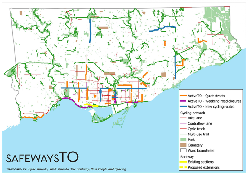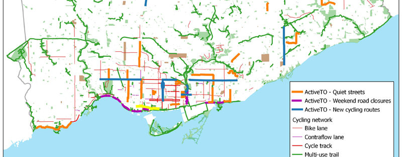
Walk Toronto has joined with Cycle Toronto, The Bentway, Park People, and Spacing Magazine to offer Torontonians a map of an emerging network of vital safe, linear public spaces or “safeways” (including slow streets and other ActiveTO closures, bike lanes, and multi-use trails), that provide city-dwellers expanded routes to navigate and enjoy safely on foot and by other forms of active transportation.
The map was created by Walk Toronto’s Sean Marshall, and it will be updated as new initiatives are announced by the city.
- See the SafewaysTO map
- Read the SafewaysTO press release (PDF)
- See the SafewaysTO website (www.safewaysTO.ca)
- Read the article by Ken Greenberg, on Spacing
A static version of the map (up to June 4, 2020) is also available.